
A lot of people would daydream about making a road trip across continents, but most would not be able to overcome the real or perceived hurdles; what made you actually do it?
We committed to the decision and then did what was necessary to make it happen. It sounds too simple, but once we made the decision and set a date for departure everything else fell into place. By “fell into place” we mean that it still took some work, but at least with every task (renting out our apartment, selling our other truck, etc) we were one step closer to leaving.
The actual decision to leave was done in a coffee shop after both of us had finished meetings with clients from our second jobs. We were working too much and not benefiting enough from it. It was time for a change and we decided on a big one. Read about the details of that exchange HERE on our very first blog post.
Do you take on jobs to support yourself along the way or do you live off the land/ your savings?
So far we have done this the old fashioned way and spent time working at our office jobs in Vancouver, BC to save money before embarking on each leg of the trip. For South America we thought we would use resources such as Freelancer.com and Odesk.com to provide a little income along the way, but a relatively quick traveling pace and lack of consistent wifi prevented this.
Desk to Glory from KOYO on Vimeo.
How much does a trip like this cost?
This all depends on where you’re travelling. When we travelled through the US it cost somewhere between $100-$150/day (all in for two of us). This high number was partly due to the fact that we could easily drive on the perfectly smooth freeways for 500 miles a day and have to fill up the gas tank a couple of times. We camped at state parks (for a fee) or spend the same amount of money on fuel hunting down free campsites. If you slow down, camp at BLM land sites, or have a vehicle you can stealth camp in you’ll be able to drop this considerably.
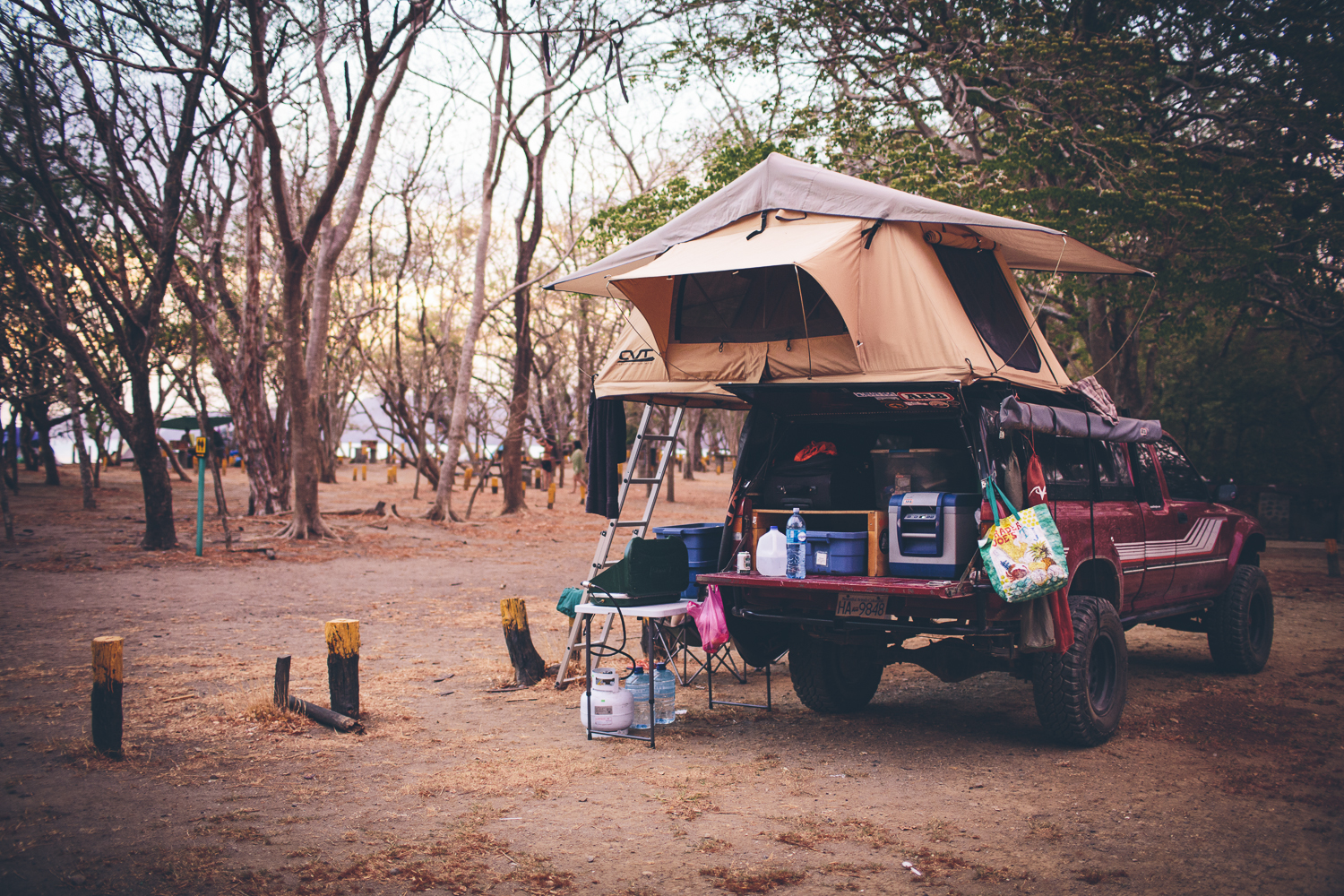
Our lowest daily budget was in Baja. We spent about $35/day. Beach camping for a week at a time, cheap produce, and cheap gas kept this number low.
On average in Mexico/Central America we spent about $70/day.
How much of your adventure is planned vs. improvised?
Very little of our adventure is planned more than a couple of days in advance. We have a general destination (Ushuaia, Argentina), we had a starting point (Vancouver, BC), and know what countries we plan on travelling through to get there. Other than that we let the trip plan itself.
We tend to meet people we meet who give us ideas of where to go and what to see. Photos on Facebook, blogs, and Instagram are great for giving us ideas of where to go next. A picture from the summit of a great hike could send us on a weeklong detour to see the same thing in person. Any time we read about or see something we like we try to make note of it so we can head there once we are in the general area. Sometimes we end up in a town and then we’ll pull out a guidebook to see if there’s anything interesting we should do while we’re there. If we like it, we’ll stay for a while. If we don’t, we may very well just keep driving through.
–
I want to drive to Central America from the US/Canada. What are your top tips?
The two biggest pieces of advice for navigation would be to use the Maps.Me app for navigation and the iOverlander.com website and iPhone app. Both work offline without cell service. Combine those with paper maps and you’ll never get stressed out about finding a place to sleep or figuring out how to get there. Make sure to download Life Remotely’s eBook to help get you through the first few border crossings. It will tell you what insurance is required for each country as well. It’s a great resource.
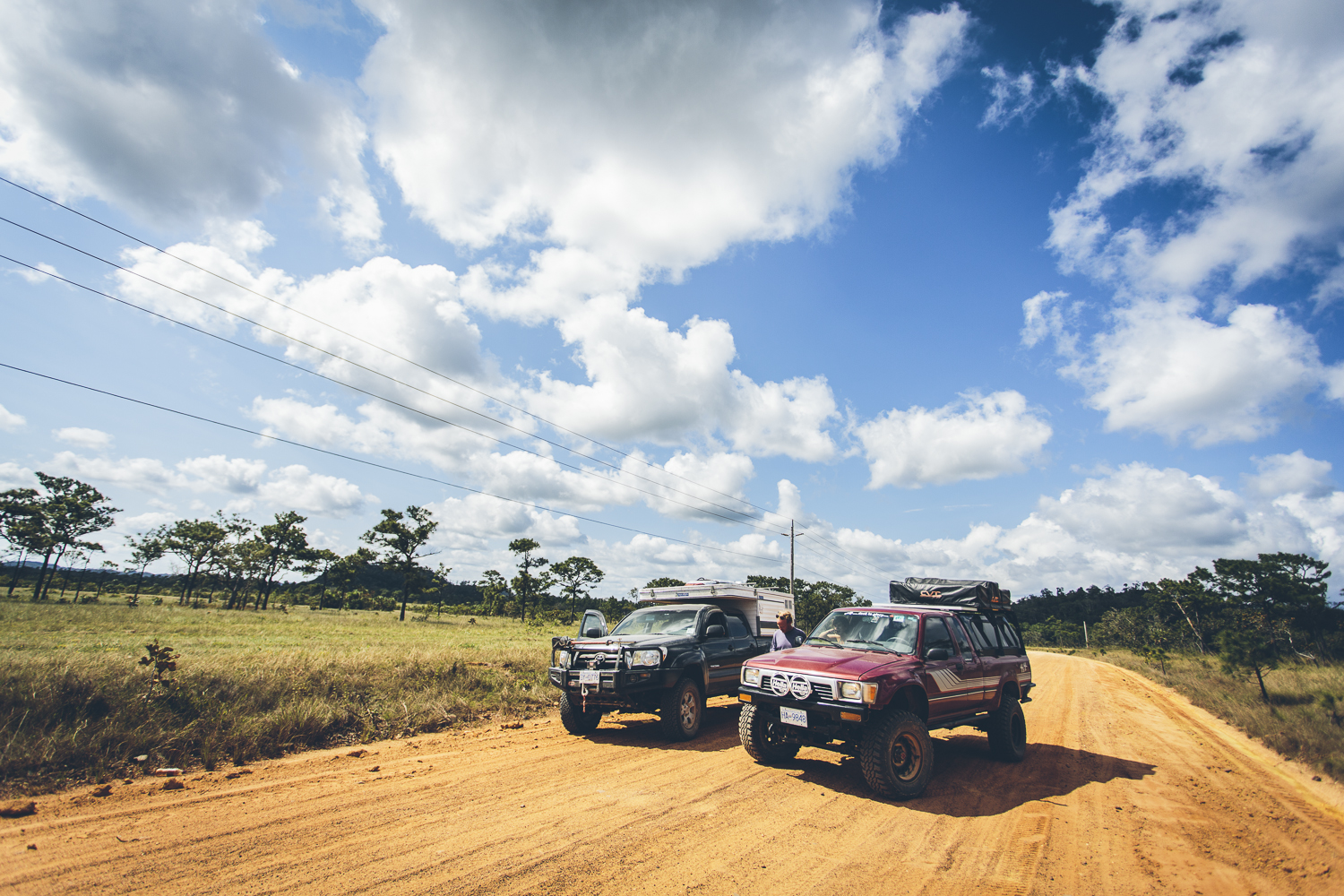
Make sure all maintenance is up to date on the vehicle you’re taking, you’ve got good tires, and a recovery kit for when you get stuck camping on the beach 😉 No matter how bad we think the roads are there always seems to be a local there who drove up in a 500,000km 1988 Corolla on bald tires so you really don’t need to invest in a kitted out 4×4.
Like mentioned before, you don’t really need anything beyond your passports, health, and cash/credit card to have a good time, but we just had friends who returned from 6 months on the road in a van and they are adding the following before heading off onto a longer journey: Better indoor living space (to cook and live inside when the weather is bad), an awning for even more living space in the hot sun or rain, and an ARB fridge to provide fresh food and cold drinks. The fridge was our #1 addition to our truck. I’m going back and forth on this, but if you can’t afford any of this gear just spend the money on the trip itself… way better money spent that way.
You don’t NEED it, but we are seriously in love with our ARB 37qt Fridge/Freezer.
–
Are you worried about the security of the truck?
We are always conscious of the security of the truck, but most of the worry is Richard’s mild OCD checking to make sure that everything is locked before we leave the truck anywhere. Our advice would be to tint your windows as dark as possible, never leave ANYTHING visible (we had a couple of books and Ashley’s glasses stolen when we left them in the cab), have a lockbox for large valuables, and include a safe for small valuables like money and passports. Essentially, just assume that somebody will break into the vehicle at some point and just make sure that the things that are valuable or mean something to you aren’t accessible without considerable work.
Oh yeah, did we mention that when we had some stuff stolen that a local security guard ran down the theif and brought our stuff back. Yup, it happened HERE.
Want more security tips? Just click HERE.
This is what our extra dark Mexican tint looks like. Stealthy! 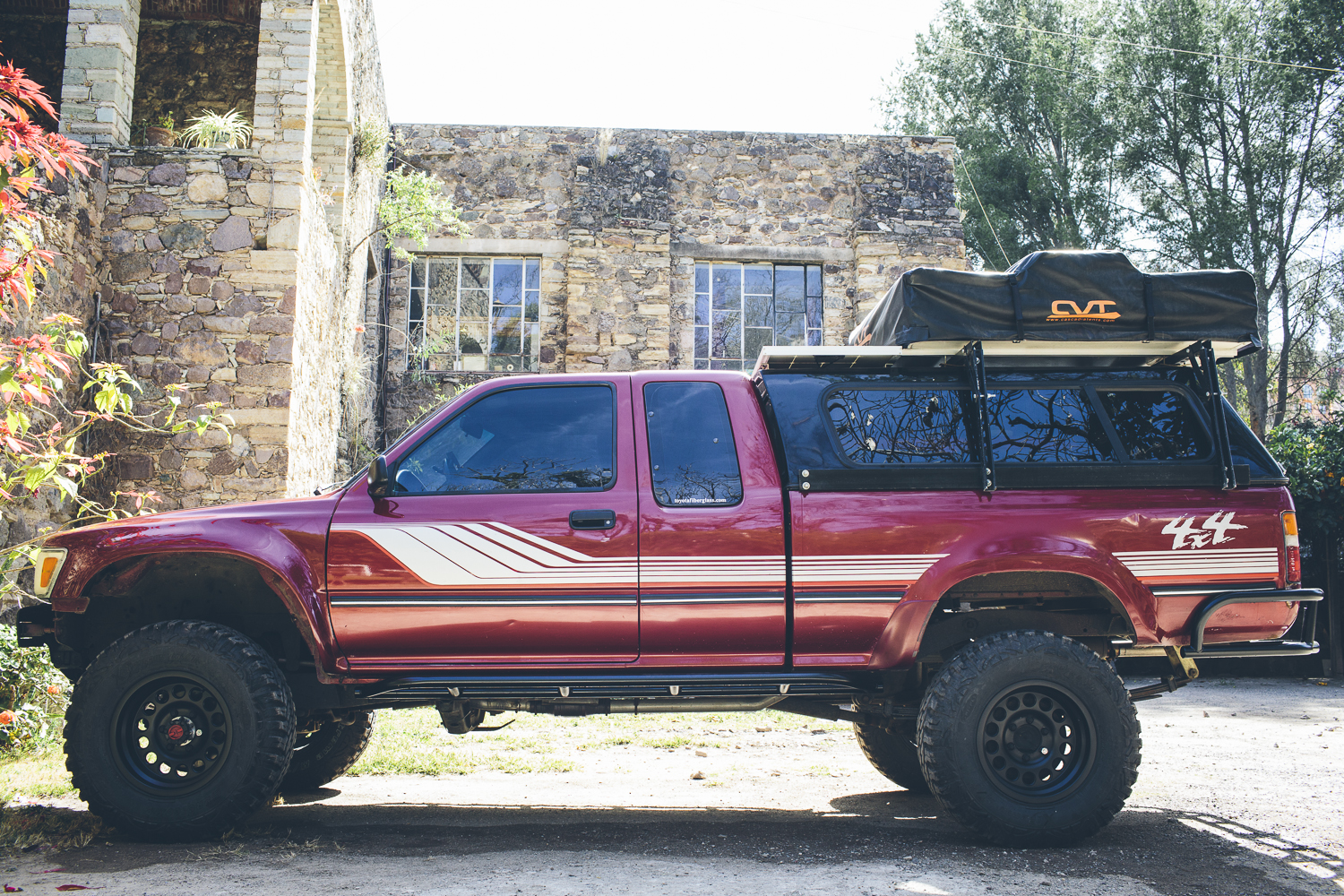
–
What about your personal safety on the roads?
We never felt threatened on the road. The usual “no driving at night” is a big one. We broke that rule and drove at night a couple of times. It was always a hair-raising experience. Livestock on the road, kids, on the road, families on the road… all in complete darkness except the light from the truck. We ran into one peaceful protest roadblock, but no other shenanigans.
You’re going to get pulled over my military and police checkpoints. 99% of the time these are routine and these guys are just doing their job. They’ll ask for your license, temporary import permit, and registration. They might you where you’re coming from and where you’re going. Then they’ll let you continue on your way. Be polite and courteous and you won’t have any problems.
If somebody is trying to solicit a bribe from you, you’ll know. The ONE time this happened we pretended like our Spanish was poor and we didn’t really understand (this was easy to do since our Spanish is not great). We just sat in the truck on the side of the road holding out on him for about 5 minutes before our license was handed back to us and we were free to go. I feel like the stories of bribes are getting fewer and far between so this isn’t something you should have to worry about. Read about our little interaction HERE.
–
What were your favourite routes in Central America?
These are mostly roads off of the beaten path that we had a blast on. Each are between 1-3 days of driving.
Baja California
Our general route and budget summary is mapped out HERE:
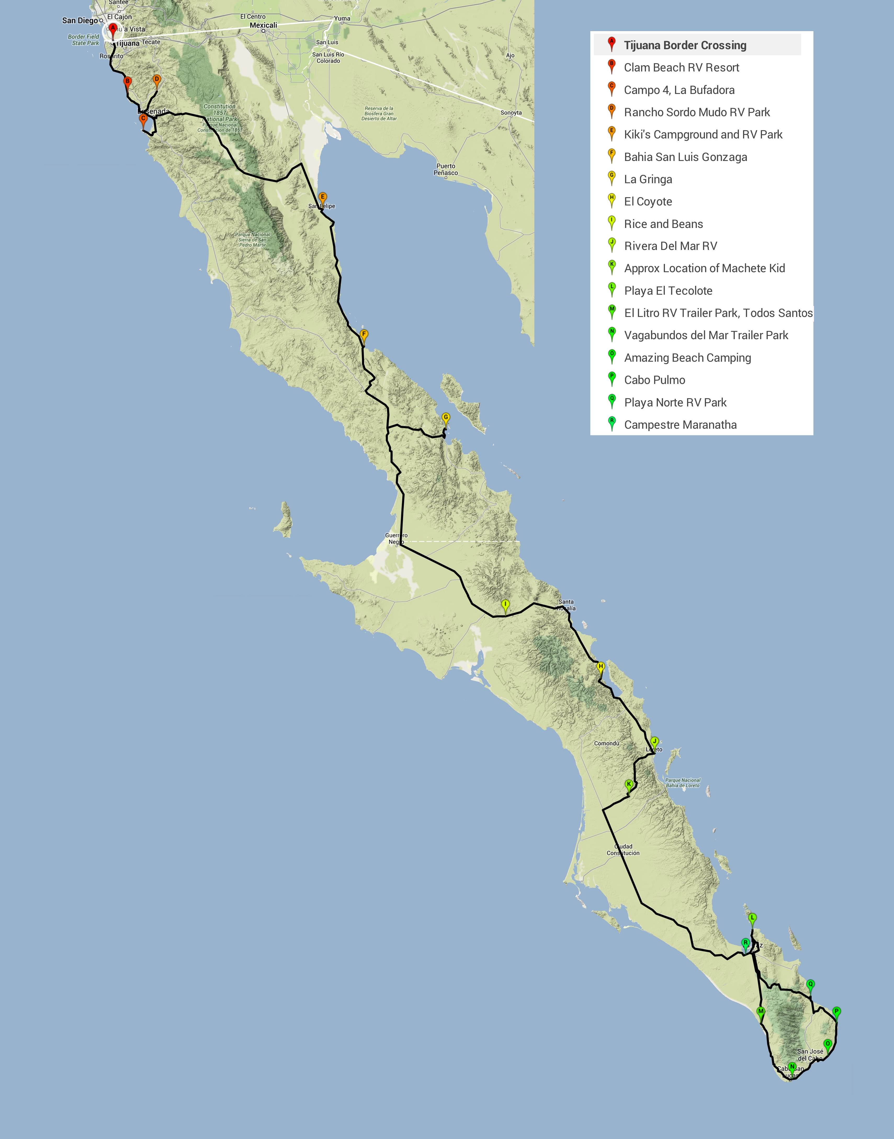
All of the places we stayed are now on iOverlander (input by Song of the Road).
We especially liked our extended beach stays at Gonzaga Bay, El Coyote, and La Gringa (Bay of L.A.)
These were a few fun routes:
South along “Highway 5” (really just a washboard/rocky track) from Gonzaga Bay (we camped at 29.788538, -114.394978, see the post HERE for pictures) to Coco’s Corner N29 31.032 W114 17.464 (Sorry for the different types of coordinates) to Highway 1. Approx 70km at 15km/h. It’s always worth a stop at Coco’s.
The road west from Loreto to San Javier Mission and then continuing west to Highway 53 We camped along a river at 25.634817, -111.619478 (Don’t let the kid with the machete scare you off). We were there a few weeks after a big storm. A lot of the road was washed out and required about five water crossings (max was 18″ deep when we were there Dec 2013). Read about it HERE.

Cabo San Lucas north-east along the coast to Cabo Pulmo and then back up to La Paz was great as well. Read more HERE.
Mainland Mexico
We didn’t explore too much off of the main roads in Mainland Mexico, but we really regret not spending any time at the Copper Canyon after seeing photos from others.
In Oaxaca we did get to spend some time in the Pueblos Mancommunados and Benito Juarez. Great views from Benito Juarez and nearby hikes. View the post HERE.
It might be fun to head through Mexico City: BLOG POST
…stop at the Teotihuacan Pyramids: BLOG POST
…or stop in Palenque: BLOG POST
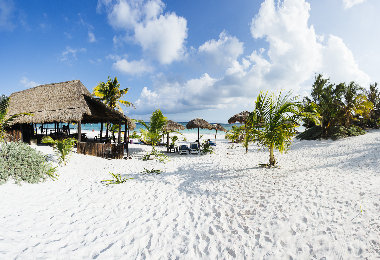
The Yucatan Peninsula will definitely be the most expensive part of the trip, but the beaches are of the nicest we saw. Click HERE for the post.
Belize
Our first day we drove to Sartejena and camped at the Backpackers Paradise Hostel. We left our truck here for three days when we took a water taxi to Caye Caulker. Click HERE for the post.
The Coastal Highway from The Belize Zoo (we didn’t go here, just using as a reference) south to where it connects to the Hummingbird Highway had great scenery. Fast dirt roads and two-track. Averaged 70-80 km/h on the dirt here. Definitely a fun road and we blogged about it HERE.
Take the Hummingbird Highway up to Spanish Lookout and be in awe of what looks like middle-America. Many Americans have relocated here and it’ll feel like you’re back home. The Sunset Diner (I think that’s the name) food truck has wicked burgers which were a nice change from rice and beans. We explored the Pine Ridge Mountain Forest Reserve (just west of Spanish Lookout) for a few days. Read more HERE.
Guatemala
Tikal is a must-see. View the post HERE.
The road (Highway 7 or 7E) from Rio Dulce to Coban and then to Lanquin was spectacular. The following day we drove from Lanquin to Semuc Champey. Mostly on dirt roads. One of the top 3 drives of our trip. Click HERE for the post.
En route along Highway 7 (or was that 7E?)

Costa Rica
The Nicoya Peninsula was another one of our favourite routes. Hwy 160 (30km/h dirt roads) south from Tamarindo to Montezuma took a couple of slow days. We were there just before rainy season and only had a couple of small water crossings to deal with. Most of the road parallels the coast so there’s always something nice to look at. Check out the blog post HERE.
–
You probably know how to fix a car and speak some Spanish, any other skills that are useful on the road?
Even those two assumptions are a little bit of a stretch! I know to limit the amount of time that the Central American “mechanics” needed to touch our truck and to do the work myself. Contrary to popular Central American mechanics belief, a bigger hammer is not always the most appropriate tool for the job. We knew absolutely no Spanish before we crossed the border into Mexico; we fumbled (mumbled?) our way through much of Mexico before taking some classes. Our understanding of the language is severely limited, but we can definitely order a good cup of coffee and a couple of tacos!
I think the biggest skill that revealed itself while on the road is our ability to adapt. We know that we might not make it to our proposed destination on a given day. Sometimes the road takes twice as long as it should, sometimes we accidentally take the wrong road, and sometimes the road doesn’t actually exist anymore. As long as we have food, water, fuel, and each other everything else is just a bonus. When you hit the road and it hits back sometimes you just have to take a deep breath, have a sip of your favorite beverage, and make a plan on how to proceed.
–
What are the bare essentials required for overlanding?
We used this list from Overland Journal as an initial checklist when putting together a recovery kit for our truck. Follow this generally and you’ll be good to go.
- Fire extinguisher
- Front and rear recovery points
- Shovel
- Jumper cables
- Drivetrain fluids
- ARB Recovery Strap
- Hi-Lift Jack 48″
(We also picked up a basic bottle jack for basic tire changes since we didn’t have the stock jack.)
- Tool kit appropriate to vehicle
- Vehicle spares appropriate to vehicle
- Full-size spare tire
- Light truck or better tires
- Spare key, hidden outside vehicle
In addition to this we brought:
- ARB Speedy Seal Tire Repair Kit
- VIAIR 90P Air Compressor
(For airing up tires after offroading or after a repair.)
- Maxtrax (They’re the simplest and safest way to extract a vehicle in many cases.)
This flat tire was repaired quickly on the side of a busy road with the ARB Speedy Seal Tire Repair Kit and air compressor.

–
What kind of camera do you use?
Richard shoots with a Canon 5D Mark III with an assortment of lenses. The Canon EF 35mm f/1.4L
is used the most, a Canon EF 17-40mm f4L
is the go-to for wide-angle shots, and a Canon EF 70-200mm f4L
is the telephoto.
Ashley shoots with her new Sony Alpha a6000. This little mirrorless camera is a great bang for the buck and is perfect for those times we don’t want to pull out a giant beast of a DSLR.
We also use GoPro Hero2 for those times when there is a risk of damaging the other cameras (on/in the ocean, during a significantly rainy hike, etc).
Interested in what makes the best camera for overlanding? Click HERE
–
What do you use to edit photos?
All of our photos go through post-processsing in Adobe Lightroom 5. We have modified/created a couple of presets to create the look we like, but sometimes we edit from scratch.
How did you get supporters?
We wrote a blog post about it!